3D visualization for infrastructure: from concept to community support
April 22, 2026
Planning infrastructure projects requires more than technical expertise.
It demands clear communication, stakeholder buy-in, and the ability to see challenges before they become costly problems.
This is where 3D visualization changes the game for municipalities, transport authorities, harbor developers, and technology infrastructure operators.
The challenge: complex architecture and engineering, simple communication
Highways, bridges, train stations, harbors, data centers, and public parks are among the most complex projects a municipality can undertake. They involve:
- Technical complexity that’s nearly impossible to convey through 2D plans and CAD drawings alone
- Community concerns about aesthetics, traffic, environmental impact, etc.
- Competing interests among stakeholders with different priorities
- Heavy regulatory requirements that demand rigorous documentation and justification
Even the most talented architects and engineers know the frustration: a functional design on paper doesn’t help stakeholders understand what it actually means for their city.
A 2D blueprint doesn’t show how traffic flows through a rerouted intersection, how a harbor redevelopment integrates with the waterfront, or how morning light hits a new transit platform.
This is where 3D architectural visualization becomes indispensable.
Why 3D visualization matters for infrastructure projects
1. Gaining immediate stakeholder understanding
When you present a major infrastructure project to a city council, community board, or harbor authority, everyone needs to understand it, but not everyone speaks engineering.
3D visualization translates technical specifications into something universally clear. Instead of interpreting contour lines and CAD notations, stakeholders can actually see the finished project in context:
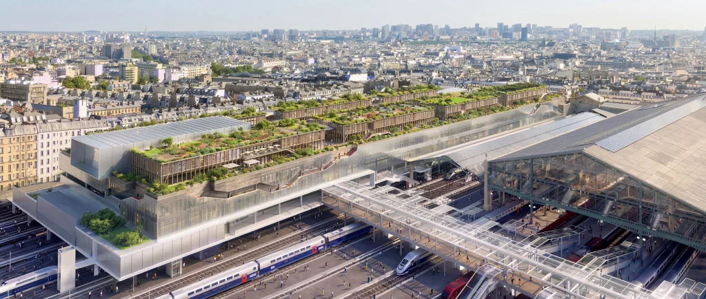
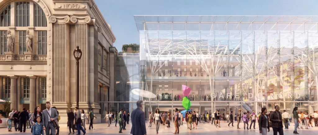
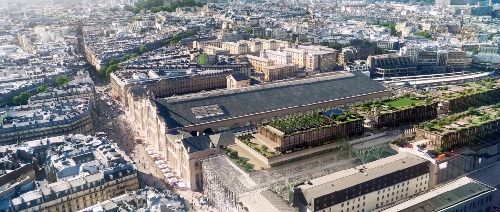
- How the new train station integrates with the existing urban landscape
- Where traffic flows through a reconstructed intersection
- How a harbor extension or bridge sits within the natural environment
- How a data center facility integrates with surrounding areas while managing visual and operational impact
- Whether green spaces are preserved or enhanced
This clarity accelerates decision-making and reduces the back-and-forth that typically delays approvals.
2. Winning community approval through emotional Storytelling
Public opposition is one of the biggest obstacles to infrastructure projects. Communities worry about:
- Visual impact and architectural compatibility
- Disruption during construction and operation
- Traffic congestion and safety
- Loss of green space or environmental damage
- For data centers specifically: cooling system, light pollution, security barriers, and visual bulk
Photorealistic 3D renderings and immersive virtual tours address these concerns directly by showing the benefits before construction begins. By using emotional storytelling to bridge the gap between technical plans and human experience, you can demonstrate:
- How a new transport hub improves connectivity while preserving neighborhood character
- Green spaces that are protected or restored
- How harbor developments can coexist with recreational and environmental zones
- How data center facilities are designed to minimize visual and acoustic impact while integrating thoughtfully with their surroundings
When communities see the positive impact with their own eyes, support emerges faster, and so do permits.
3. Demonstrating sustainability and environmental commitment
Modern infrastructure increasingly incorporates eco-friendly technology: renewable energy systems, water management solutions, wildlife corridors, and carbon-neutral operations. Yet these innovations often remain invisible in traditional presentations.
Precise 3D visualization makes the environmental case visible:
- For transit projects: show energy-efficient station design, renewable power systems, and reduced emissions
- For harbor developments: demonstrate environmental protection measures, wetland restoration, or marine habitat integration
- For road projects: highlight sustainable drainage, noise barriers, and ecological corridors
- For data centers: visualize renewable energy integration, advanced cooling systems, and landscape design that minimizes environmental footprint while supporting local biodiversity
This transparency helps decision-makers feel confident that infrastructure investments align with sustainability goals.
4. Identifying and solving problems early
3D visualization also serves as a powerful problem-solving tool.
By building a digital model early in the design phase, our team identifies potential clashes and conflicts that would otherwise only emerge during construction:
- Underground utilities conflicting with tunnel routes
- Structural conflicts between new elements and existing infrastructure
- Accessibility or traffic flow issues that need redesign
- Environmental or regulatory oversights
Catching these issues digitally saves months of delays and thousands in unexpected construction costs.
5. Communicating movement and real-world performance
Infrastructure is rarely static. A new intersection, transit hub, or harbor is a living system where people move, vehicles flow, and the city functions.
This is why still images often fall short. 3D animation shows:
- Traffic flow patterns during peak and off-peak times
- Pedestrian movement and safety sightlines
- Vehicle circulation and parking flow
- Public transport integration with surrounding areas
- How the project functions across the full 24-hour cycle
For municipalities and transport authorities, this movement-based visualization proves how the design actually works in the real world, not just how it looks.
How Illuminize supports infrastructure projects
With our background in both architecture and high-end CGI, we combine technical expertise with visual storytelling. For infrastructure clients, we deliver:
- Accurate 3D models built from engineering specifications and CAD data
- Contextual visualization showing the project within its real urban or natural setting
- Community engagement materials that build support before and during construction
- Performance visualization demonstrating how the infrastructure functions in real-world conditions
- Problem-solving during the design phase to prevent costly revisions
Ready to bring your infrastructure project to life?
Whether you’re planning a new transport hub, restructuring a major intersection, building a bridge, developing a harbor, siting a data center facility, or reimagining public space, your project deserves to be seen clearly and compellingly.
Our international team combines architectural understanding with technical precision and design excellence. We speak the language of both engineers and communities, and we deliver visualizations that build confidence in your vision.
Let’s build the future together. Contact us to discuss your infrastructure project.